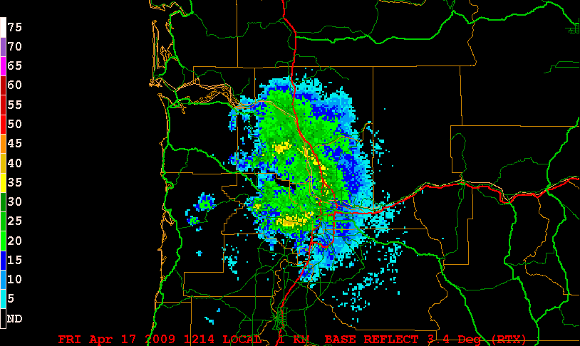
The radar "bright band" is a phenomenon that shows up as higher reflectivity near the elevation of the melting layer between snow and rain.
As mentioned in conjunction with the radar equation, the complex index of refraction for ice is 0.197 while it is 0.93 for liquid water. This means that liquid water is considerably more reflective than ice for microwave radiation. We also know that the reflectivity factor is proportional to the 6th power of the particle size. Since snowflakes are usually larger than raindrops, their size compensates somewhat for the lack of ice reflectivity, and they still show up pretty well on radar (although as previously mentioned, sometimes clear-air mode is used in snowstorms so as to be able to better view details of the reflectivity).
The bright band occurs in the layer where snowflakes are melting into rain:
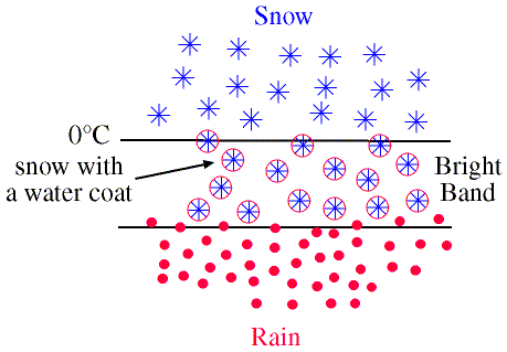
Two effects are occurring. The first is that when the snowflakes first start to melt, they melt from the outside in, so at first they have nearly the diameter of a snowflake (large) but are coded with liquid (high index of refraction), both combining for a high reflectivity. The second effect is that as the snowflakes melt and shrink into liquid water drops, their terminal velocity increases, and they start to fall faster, leaving fewer of them in the radar-sampled volume just below the melting layer. Hence the bright band becomes a vertical maximum in the reflectivity.
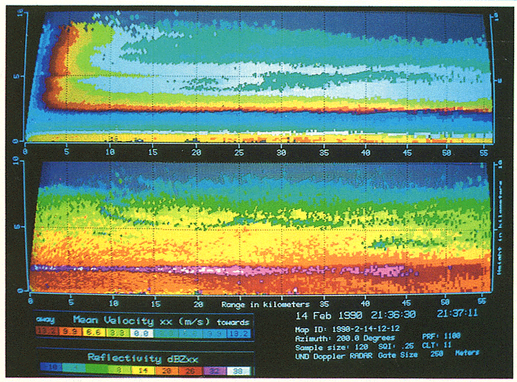
The bright band is best seen on RHI displays (second panel):
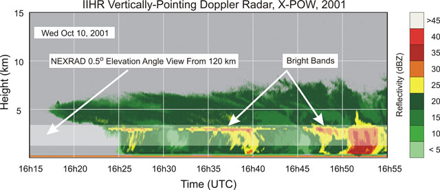
It also can be seen in hieght-time plots of radar data from vertically pointing radars:
On a PPI display, the bright band will be seen at the range where the radar beam cuts through the vertical level of the melting layer. This is close in to the radar on the higher tilts. Bright bands can best be seen in GARP in the base reflectivity for the 1.5 degree (N1R in GARP) and 3.5 degree (N3R in GARP) tilts.
Bright band at N3R from Goodland, Kansas.
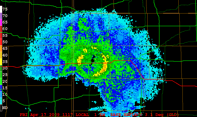
Bright band at N3R from Portland, Oregon.