by Dr. Brad Muller
Chaff is a radar countermeasure used by the military to distract enemy radars from their true targets, the military aircraft. For example, it works as a decoy to confuse radar-guided missles:

from Arnott et al, Desert Research Institute.
Two Youtube videos give a brief description of chaff and how it is deployed (see ~00:58 sec mark for animation of deployment).
It can consist of small pieces of aluminum, metallized fiberglass, or plastic released from the aircraft. Optimal effect is from pieces about 1/2 the wavelength of the radar. Typical chaff used by the military consists of tiny wires composed of a fiberglass (SiO2 amorphous glass) core coated with aluminum:
Cross section view:

from Arnott et al, Desert Research Institute.
Navy chaff:

Air Force Chaff

Chaff blows with the wind and settles out of the air at approximately 20-50 cm/s or faster if it clumps together.
It is designed to obscure targets on radar, so naturally it shows up in weather radar. It can often be seen in or near Florida and other places during military training.
ERAU student, Kermit L. Lacey, USN Retired, emailed me the following explanation with a couple of slides of sectional charts that put into context the chaff examples below that I have collected:
"Here are a couple of slides I dug up from work. This illustrates the two Air to Air Training Areas that are nearest to us here in Daytona Beach. They are basically deconfliction ranges set up about 200 x 100 nm. It's open (restricted) airspace that the AF and Navy use to run air to air intercepts. During these intercepts, at specific times while the fighters and the bandits proceed into the merge (dog fight), they will pump out (decoys) expendables (both chaff and flares, for Radar Seeker and IR threats respectively). The number of decoys deployed solely depends on the pilots SA and overall training. In a standard section flight (2 a/c), the decoy deployment can be significant, and that's not counting what the Bandits are deploying. We usually operate in block altitudes between 25k - 35k feet, so this can explain the weather radar phenomena you have documented.
Also, Naval ships employ chaff as decoys to thwart anti-ship cruise missile threats. But this chaff is deployed on a much larger scale. You may see this all along the east coast in the JAX and VACAPES Operating areas while training is conducted."
--Kermit Lacey, USN, Retired.
Example 1: The case described below showing chaff in the legacy reflectivity product, N0R, may be related to training operations out of Eglin Air Force Base:

Four nearly simultaneous NEXRAD radar views of chaff from Nov. 6, 2007 near 1900Z are apparent in the following views from the Tampa (TBW), Melbourne (MLB), Jacksonville (JAX), and Tallahassee (TLH). Which is running in Clear Air Mode?


The GOES-12 visible satellite image for this time shows very few clouds in the area:

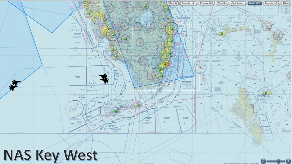
The following two examples may be training operations out of the Naval Air Station in Key West:
Example 2: Note the switchover from clear air mode to precip. mode in the legacy N0R product:
Florida chaff animation
Example 3: Chaff seen at different tilts in the high resolution base reflectivity products:
N0Q--0.5 degrees
N1Q--1.5 degrees
N2Q--2.4 degrees
N3Q--3.1 degrees
N0Q at 22:27Z 3/6/2018 from KBYX:

Example 4: The following example is an apparent case of chaff related to military training operations along the California coast. Note that the dual polarization hydrometeor classification product, HHC, and the correlation coefficient product, N0C, are both useful in discriminating chaff from precipitation. The HHC product is indicating biological scatterers (BI), which in this case is a surrogate for non-meteorological echoes, since there is no separate category specifically for chaff. Precipitation usually shows up as red in the N0C product due to CCs higher than 0.9. The spikes that follow the chaff area are most likely from an independent source of microwave radiation interference, perhaps another radar(s), possibly that is tracking or being decoyed by the chaff and apparently being scattered toward the NEXRAD antenna.
N0Q--high res. reflectivity
HHC--hydrometeor classification product
N0C--correlation coefficient product
N0Q at 23:57Z 3/29/2018:

HHC at 23:57Z 3/29/2018:

N0C at 23:57Z 3/29/2018:

Visible satellite imagery from GOES-13 confirms that only stratus clouds are present over the ocean, with no features that would be capable of producing rain showers.

Enhanced IR: Only low clouds (stratus) are present over the ocean.

Example 5: The following example illustrates how the correlation coefficient product is useful at discriminating chaff from precipitation. The chaff near South Florida is not all that easy to distinguish from precip. in the reflectivity product. However, the correlation coefficients for precip., such as the echoes over Cuba, are typically greater than 0.9 and show up as maroon and yellow, while the CCs for chaff typically are below about 0.75, and show up as blue or grey.
N0Q--high res. reflectivity
N0C--correlation coefficient product
Reflectivity, N0Q:

CC, N0C:
