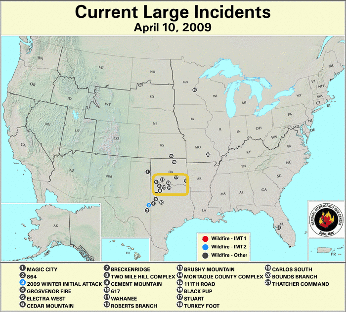
Fires on April 9, 2009 present a good case for the use of satellite imagery in fire detection and tracking.
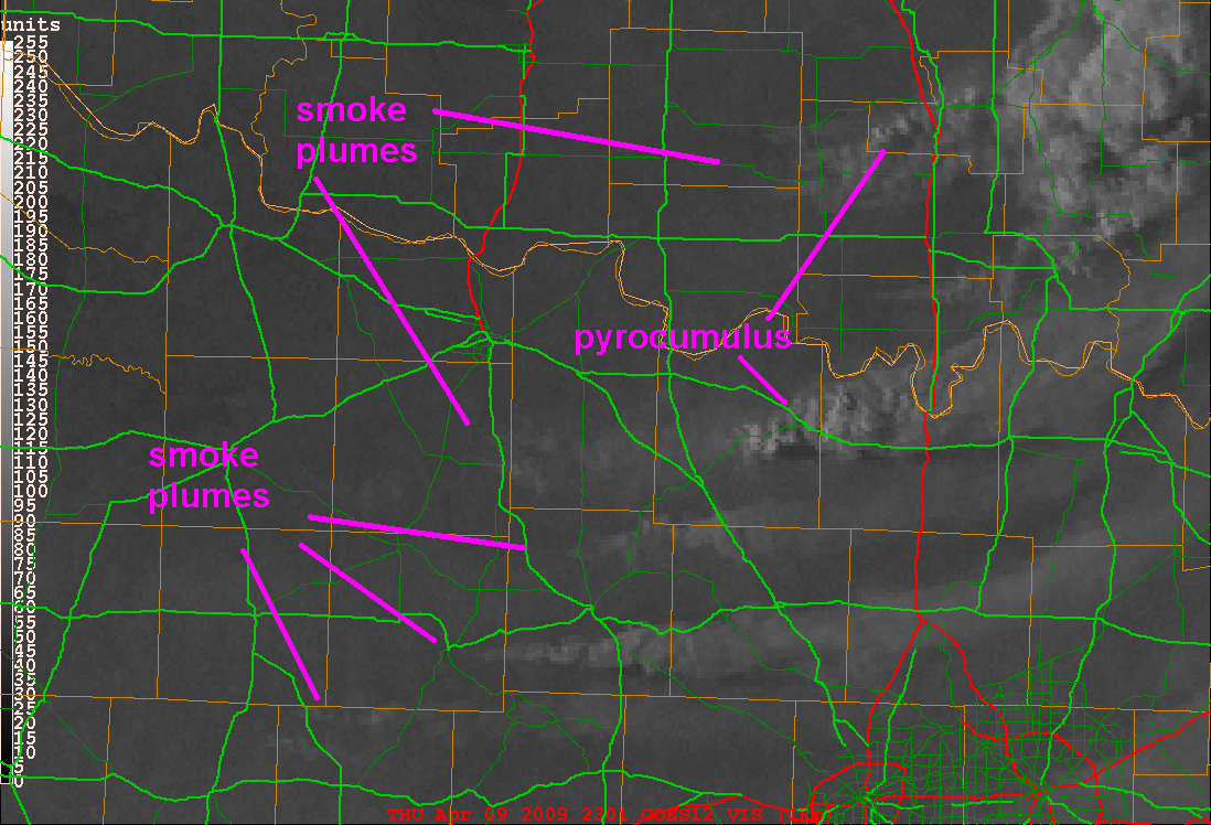
Smoke plumes from some of these fires is evident in the following visible satellite image. See animation. The Dallas/Ft. Worth area is at the lower right of the images.
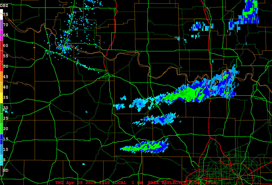
Occasionally plumes from fires can be seen in NEXRAD radar imagery. Presumably, what we are seeing in these images from the Frederick, Oklahoma radar are the large ash particles rather than the smoke particles, which most likely are too small to have much reflectivity for a 10 cm wavelength radar beam. See animation.
The GOES 3.9 micrometer near IR satellite channel helps confirm where there are large fire hotspots which show up as black spots in the imagery. See animation.
