Please check this page from the National Hurricane Center for climatological information on the occurrence of hurricanes in the United States.
Hurricanes (also known regionally as typhoons and cyclones) are the most intense example of a whole range of tropical weather systems. They form in specific oceanic "basins" where conditions of conditions of warm ocean temperatures, weak vertical wind shear, and incipient disturbances supplying cyclonic vorticity (spin) are all prevalent:
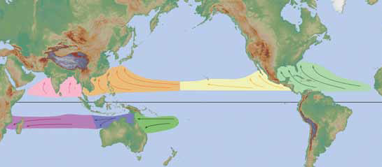
Image credit: NWS Jetstream
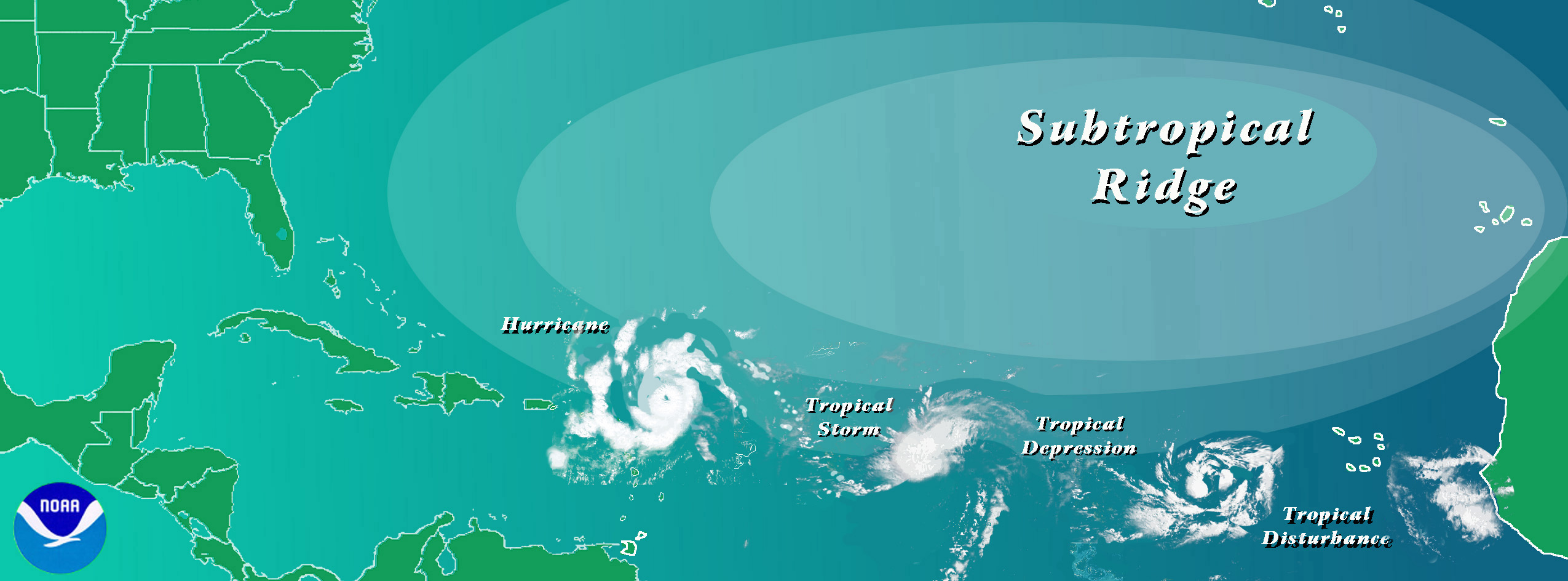
They begin as semi-organized areas of thunderstorms in the tropics called tropical disturbances and progress through the following sequence :
Tropical disturbance => tropical depression (<39mph [34 kt]) => tropical storm (39-73 mph [34-63 kt]) => hurricane(74+ mph [64 kts])
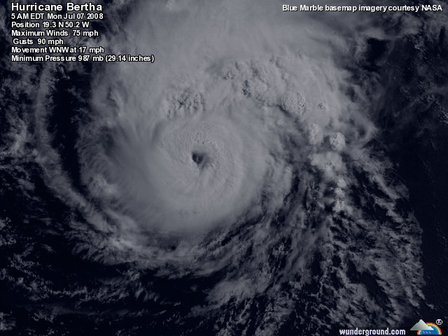
This process is depicted in the Atlantic hurricane basin below. The latter three types of systems have closed (rotating) circulations, that is, there is a low pressure center, and are classified generically as tropical cyclones.
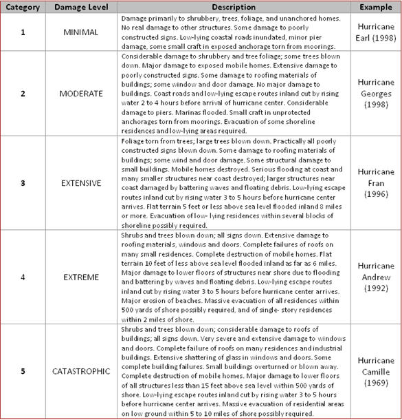
Hurricanes are often classified by the Saffir-Simpson scale defined by the speed of the maximum sustained wind measured in the storm:
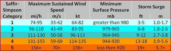
A Category 5 storm is much more damaging than a Cat. 4 because the kinetic energy, and therefore force, of the wind increases with the square of the wind speed.
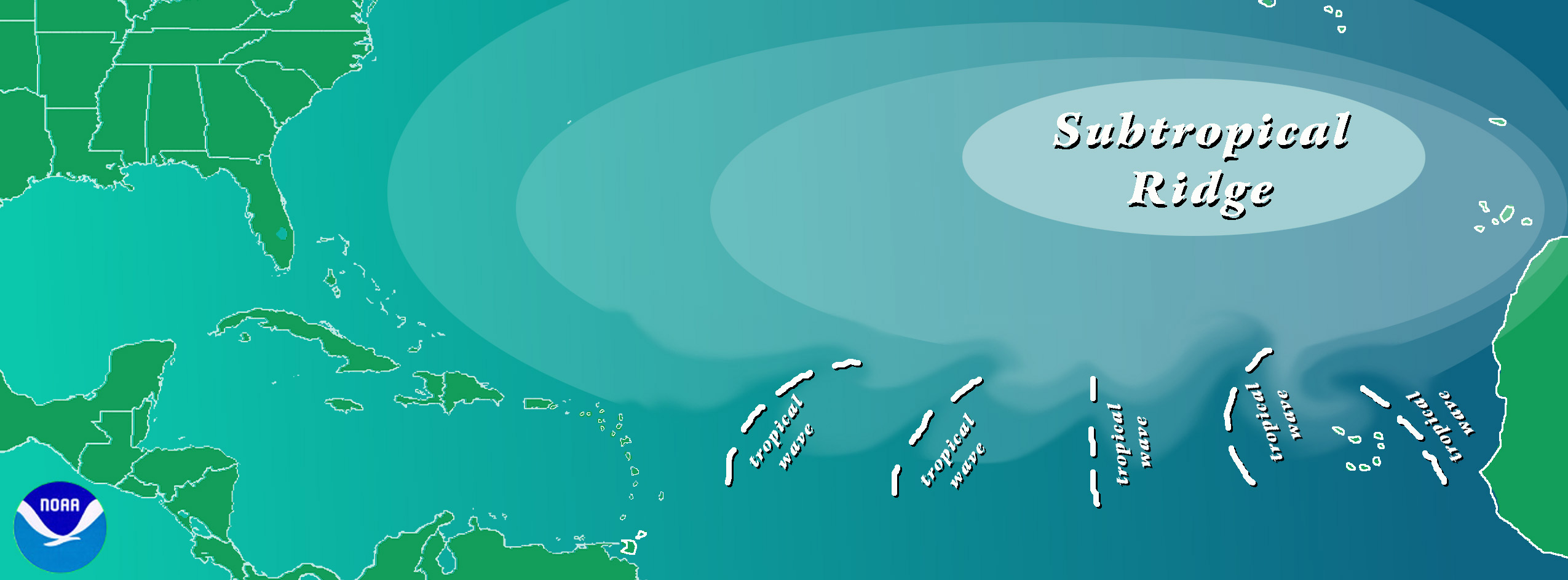
Formation in the Atlantic hurricane basin
Hurricanes form from incipient disturbances in tropical weather that create groups of thunderstorms. The thunderstorms release latent heat which begins to build higher pressure aloft (remember, isobaric surfaces are farther apart in warm air), but low pressure at the surface. The high aloft creates divergence aloft which leads to more lowering of pressure at the surface.
There are several examples of incipient tropical disturbances that may develop into hurricanes if conditions are right (usually water temperature above 26oC, and weak vertical wind shear):
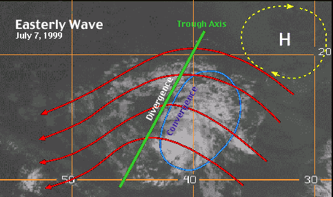
1. Easterly Wave: Also called tropical wave, this is an inverted trough of low pressure moving generally westward in the tropical easterlies. A trough is defined as a region of relative low pressure. From the National Hurricane Center: "While only about 60% of the Atlantic tropical storms and minor hurricanes ( Saffir-Simpson Scale categories 1 and 2) originate from easterly waves, nearly 85% of the intense (or major) hurricanes have their origins as easterly waves (Landsea 1993)".
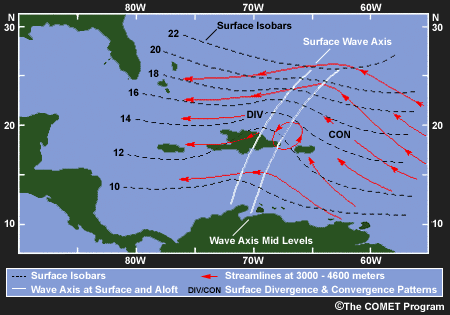
Many begin over Africa and progress westward over the Atlantic:
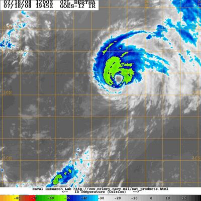
In satellite imagery they appear as concentrated groups of clouds mostly on the east side of the inverted trough, best seen in IR because their cold tops allow them to be distuinguished from lower level clouds:
IR image with inverted trough superimposed.
IR satellite animation of an easterly wave.
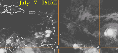
Visible image of an easterly wave.
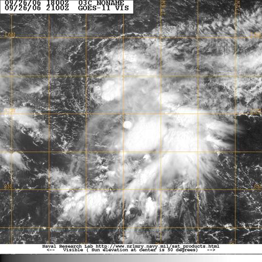
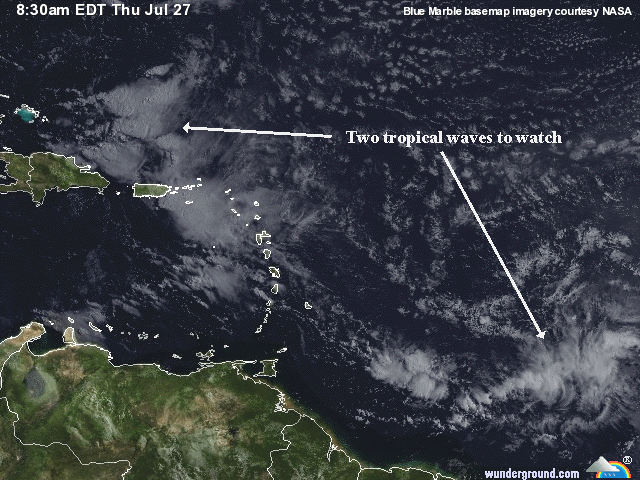
Visible image of two easterly waves.
2. West African Disturbance Line (WADL): This is a line of convection (similar to a squall line) which forms over West Africa and moves into the Atlantic Ocean. WADL's usually move faster than tropical waves.
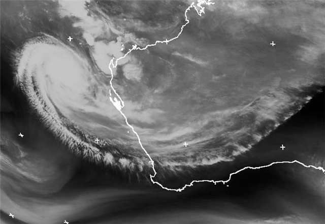
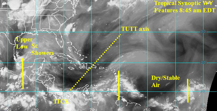
3. TUTT (Tropical Upper Tropospheric Trough): A trough, or cold core low in the upper atmosphere, which produces convection. On occasion, one of these develops into a warm-core tropical cyclone, but they can either help or hinder tropical cyclone development depending on where the surface low is developing in relation to the upper trough.
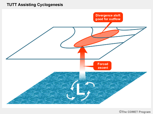
The shear zone on the south side of the trough can impede hurricane development.
TUTT on a satellite water vapor image.
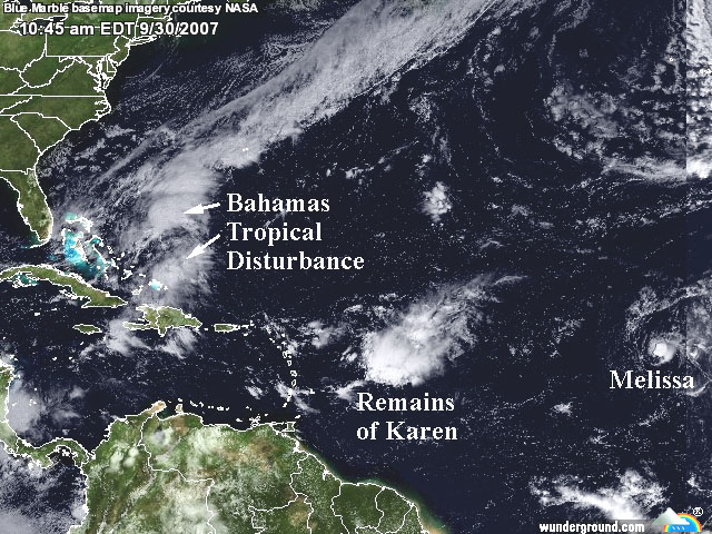
4. Old Frontal Boundary: Remnants of a polar front can become lines of convection and occasionally generate a tropical cyclone. In the Atlantic Ocean storms, this will occur early or late in the hurricane season in the Gulf of Mexico or Caribbean Sea.
Tropical disturbance near the Bahamas at the tip of an old frontal boundary.
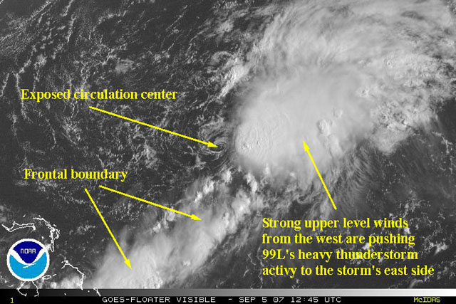
Tropical depression on an old frontal boundary. In the early stages, the convection is often sheared away from the center of the surface circulation.
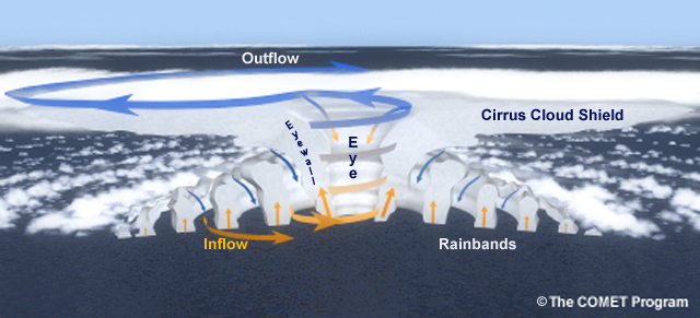
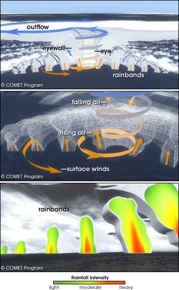
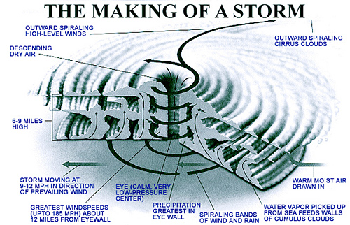
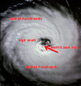
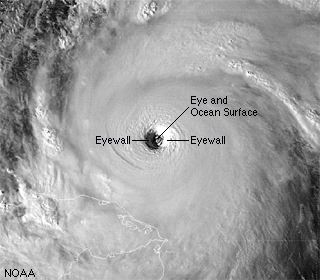
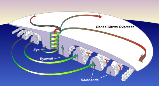
Structure of Hurricanes
Hurricanes are warm core storms meaning they are composed of a single warm (maritime tropical) air mass, have low pressure at the surface but weaken and become an anticyclone aloft, and therefore contain their storngest winds just above the surface (friction slows down the surface winds somewhat). Thus they are fundamentally different from mid-latitude lows which have fronts, are cold-core systems, strengthen aloft and tilt with height to the west.
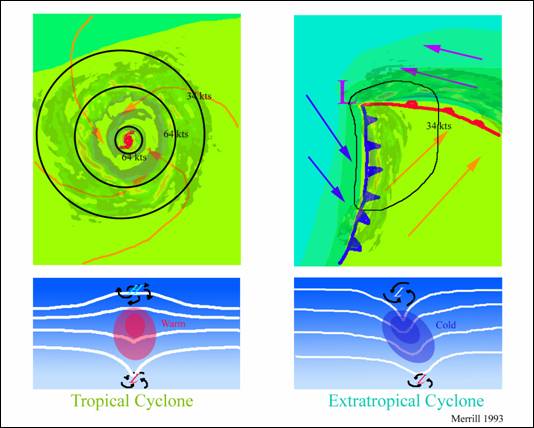
Hurricanes have air spiraling inward at the surface, sinking air in the eye, rising air and sometimes thunderstorms in the eyewall and the rainbands, and sinking air between the rainbands and outside the storm.