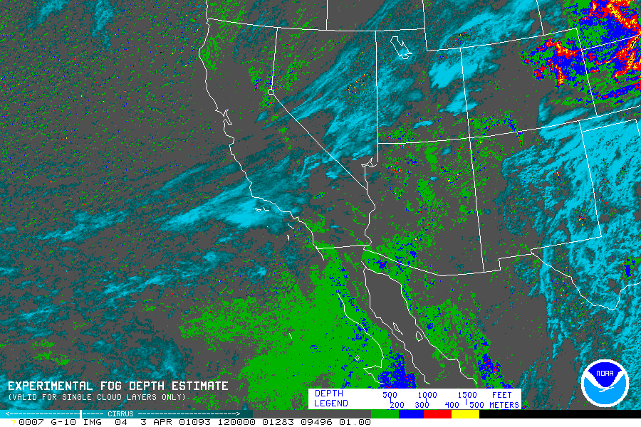
A special fog depth color enhancement based on the temperature difference between GOES IR Band 2 (3.9 mm) and Band 4 (10.7 mm) shows approximate depth of low level clouds and fog. The color steps show increasing cloud depth, from green (0 - 200 m) to black (> 500 m). The cloud depths obtained from this product are valid only for single cloud layers.
Here is a sample fog depth image from GOES-10 for the Southwest United States on 3 April 2001 at 1200 UTC. The thicker cloudiness in the High Plains is upslope stratus.
The graph below shows how the Red-Green Blue (RGB) color intensities vary with input brightness level (counts).
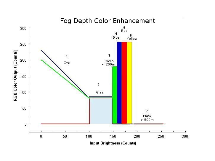
Here is a table showing breakpoint color values for input brightness ranges and IR DT values for Band 4 (10.7 mm) - Band 2 (3.9 mm).
| Cirrus | ||||||
| No cloud | ||||||
| Low cloud <200 m | ||||||
| Low cloud 200-300 m | ||||||
| Low cloud 300-400 m | ||||||
| Low cloud 400-500 m | ||||||
| Low cloud >500 m |
For further information please contact: Gary Ellrod