Infrared Imagery
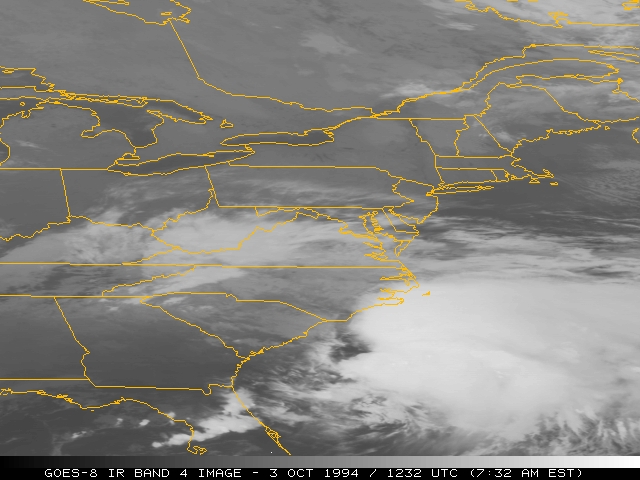
Infrared satellite imagery is derived from terrestrial radiation emitted in the 10 to 12 µm
region and provides information on the temperature of the underlying surface or cloud.
Areas with low(high) emitted Earth energy would
contain low(high) brightness values. Since radiant exitance is proportional to temperature as stated in the
Stefan-Boltzmann Law, clouds in the upper atmosphere with colder tops would appear relatively dark in raw thermal
IR imagery. However, by meteorological convention, the relationship between emitted energy and brightness values are
inverted for thermal IR imagery such that cold cloud tops and cold surfaces appear bright.
In this image:
Clouds appear in light (or nearly white) shades against the darker (warmer) background of the earth.
Since temperature normally decreases with height, the infrared radiation with lowest intensity
is emitted by the highest and coldest clouds, appearing nearly white.