Thunderstorm Outflow
Boundaries
Dr. Brad Muller
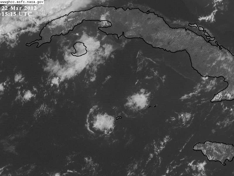
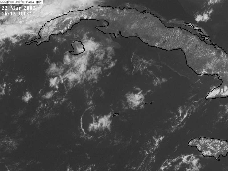
Visible
Image
Loop of Thunderstorm Outflow Boundaries
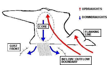
Outflow boundaries or "gust fronts" constitute the leading edge
of
evaporatively cooled downdraft air produced by thunderstorms in
their
mature stage.
Downdraft air hits the surface and spreads outward. There
is
convergence and lifting along the gustfront, producing a line of
low-level clouds visible in satellite imagery.
In ordinary (non-severe) thunderstorms, the gust fronts often
spread
out far enough to choke off the original storm updraft, and the
storm
dissipates.
Sometimes lifting along the gust front is enough to serve as a
trigger
for new thunderstorm development.
Below, the outflow boundary or gust front can be seen as an
expanding ring of clouds
around a dissipating thunderstorm cloud mass south of Cuba about
2/3 of
the way down in the images:
Here are some outflow boundaries just north of and over the
Yucatan
Peninsula of Mexico; note the outflow boundaries interacting
with the
sea breeze front:
Visible
Image
Loop of Thunderstorm Outflow Boundaries in the Yucatan
Here is a loop of super-rapid scan imagery (every 1 minute!) of
the sea breeze front over Florida spawning thunderstorms which
then spawn outflow boundaries that interact with each other and
the sea breeze front to produce new convective development:
Super Rapid Scan Imagery of gust front-sea breeze interaction
over
South Florida.