(see p. 118, An Introduction to Satellite Image Interpretation)
Dr. Brad Muller
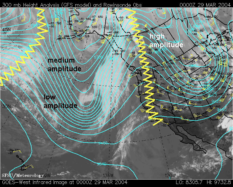
Upper level clouds often form
ahead of a trough between the
trough line and the downwind ridge line in response to large scale
upper level divergence in that region. Sometimes the ridgeline in
the satellite imagery can be detected as the location at the right edge
of the upper clouds.

We can use ridgeline cloud patterns to distinguish three different ridge types:
1. High amplitude--east edge of cloud band stops at ridgeline.
2. Medium amplitude--east edge of cloud band extends somewhat past the ridgeline.
3. Low amplitude--east edge of cloud band extends well past ridgeline, almost to the
downstream trough line.