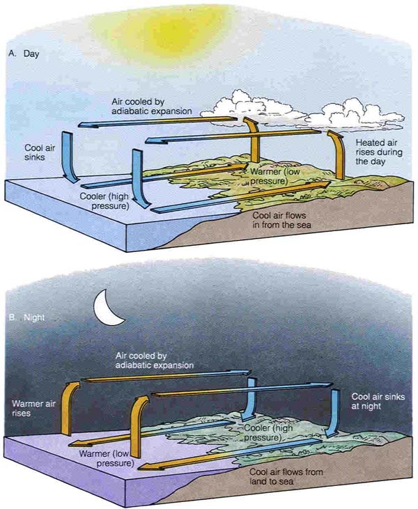
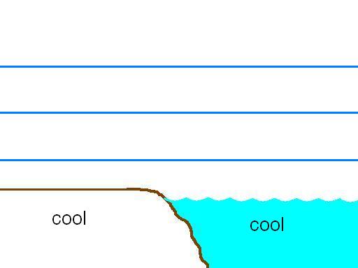
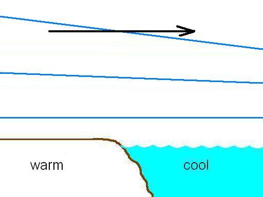
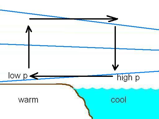
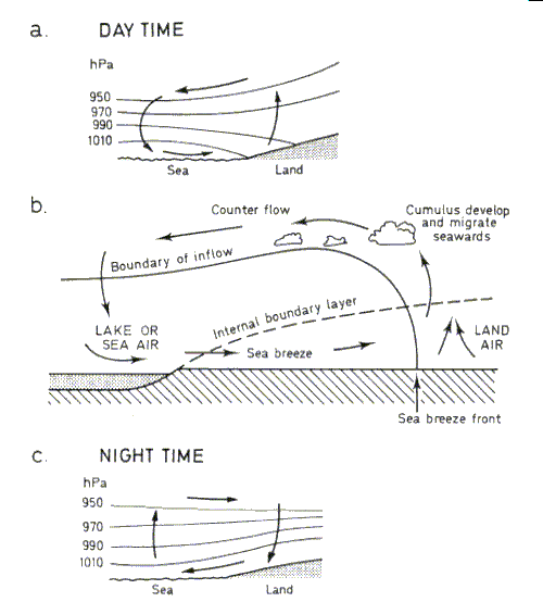
The sea breeze is a shallow (~ 1000 m) atmospheric thermal circulation that sets up in response to temperature contrast between the land and the ocean. It occurs in the daytime when the land heats up and the ocean temperature remains relatively constant. The sea breeze blows from the cool ocean toward the warm land.
The land breeze is similar but blows at night from the cool land toward the relatively warmer ocean.
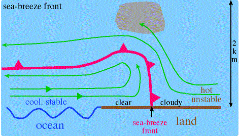
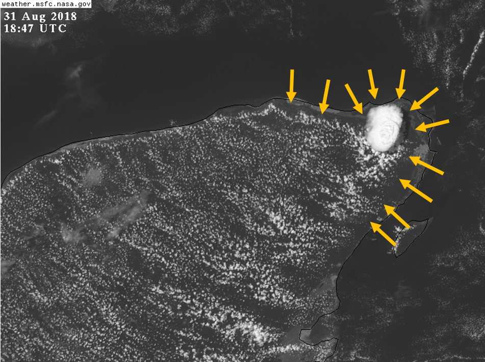
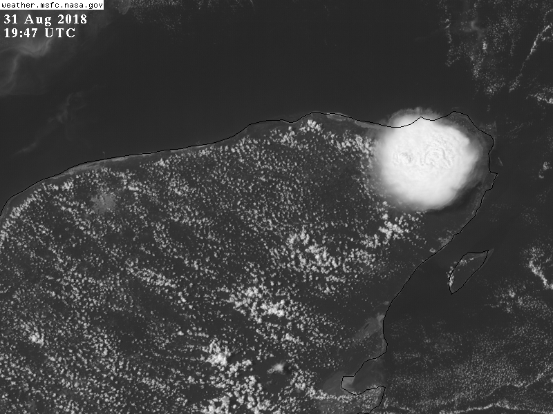
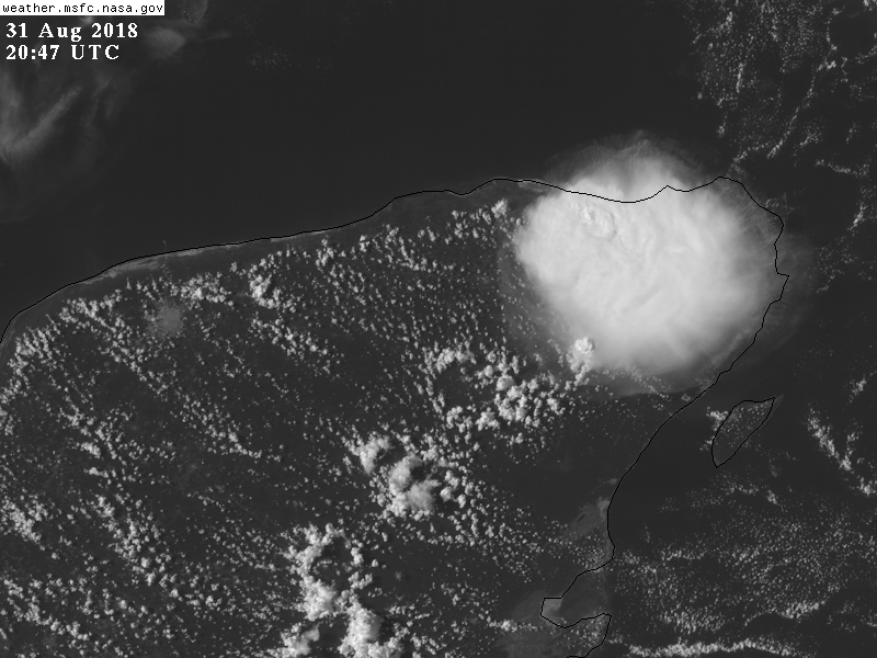
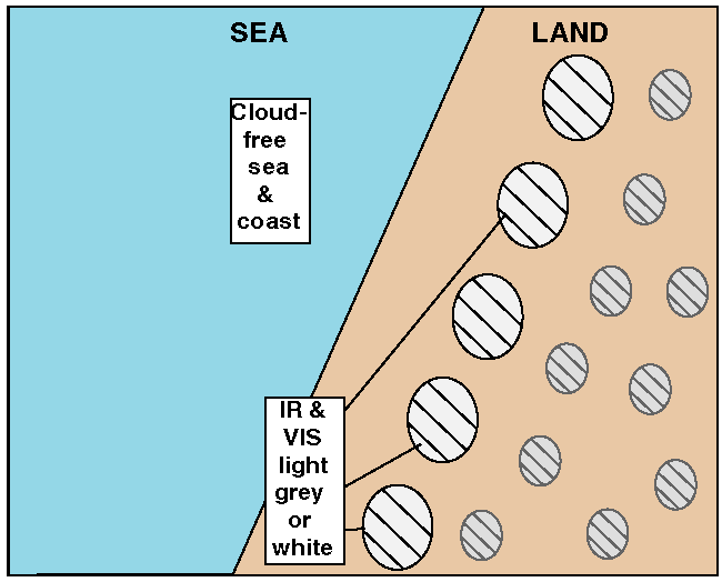
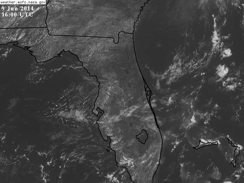
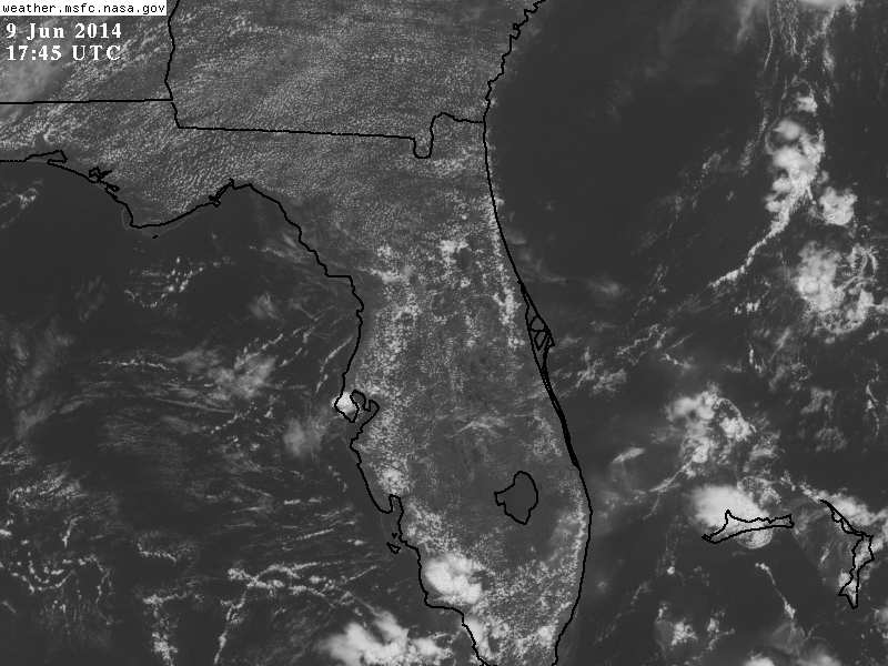
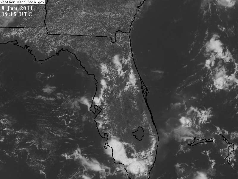
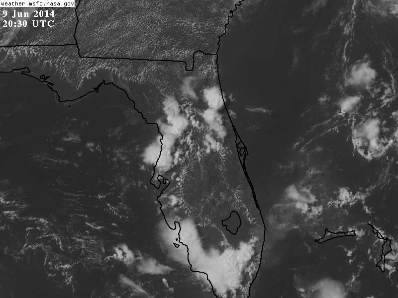
In satellite imagery, sea breezes are often characterized by a region of clear (more stable) oceanic air moving inland. The inland continental air contains cumulus clouds because it is more unstable due to solar heating of the land surface. The line between the clear and cloudy areas is the sea breeze front.
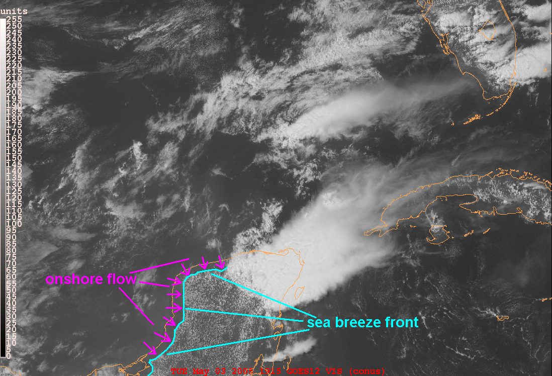
Visible Image Loop of Sea Breeze and Thunderstorm Outflow Boundaries in the Yucatan
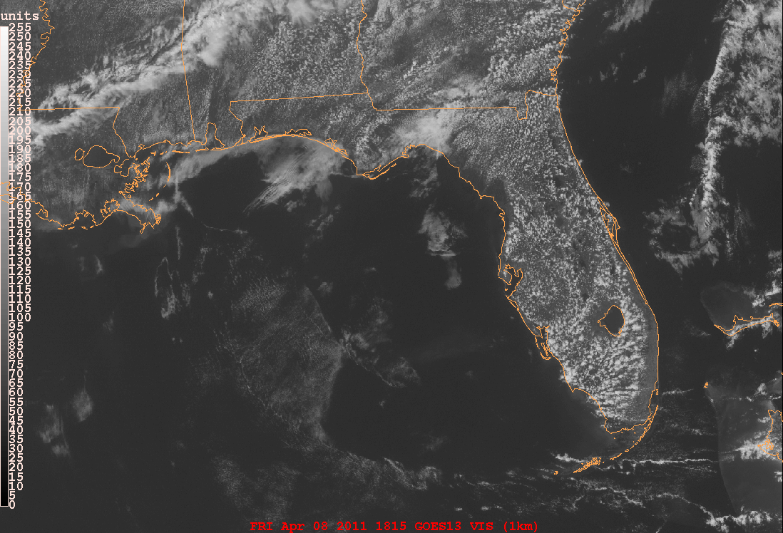
Florida typically has both a west coast sea breeze (westerly winds bloring onshore from west to east) and an east coast sea breeze (easterly winds blowing onshore from east to west), occasionally with the respective sea breeze fronts meeting in the middle of the state.
Animation.
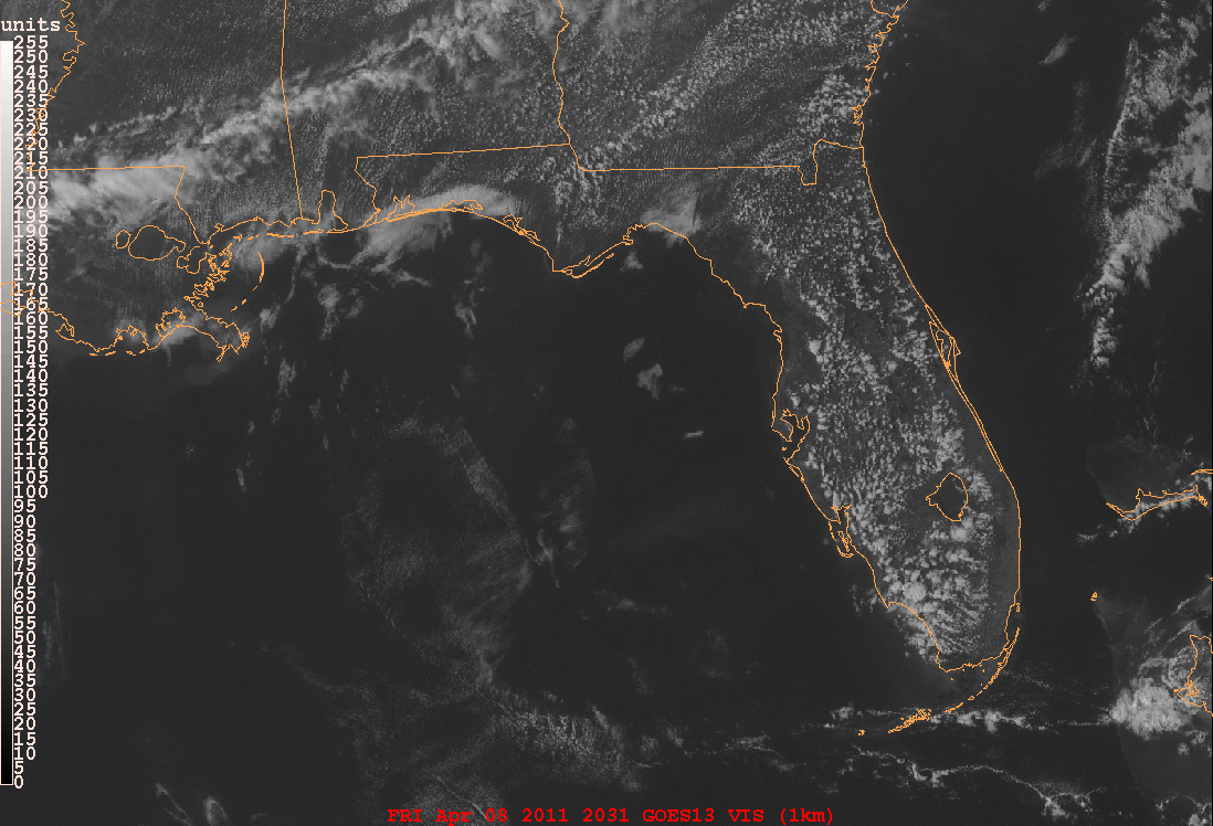
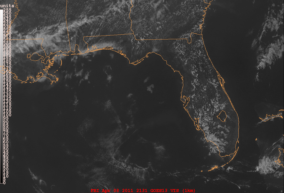
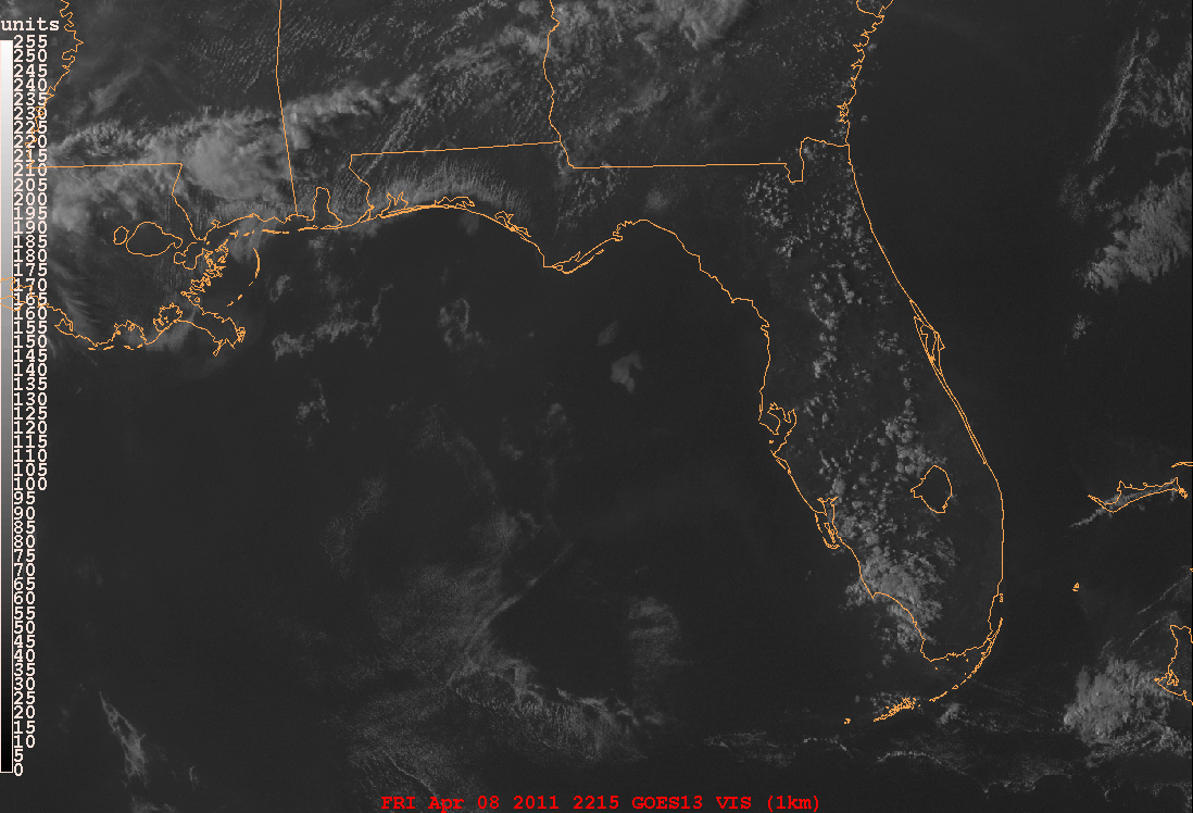
Florida's weather is especially influenced by sea breezes and the sea breeze front, especially during the warm season. The first deep convection of the day, that is, thunderstorms, usually initiate along the sea breeze front.
Animation of Florida sea breeze convection.
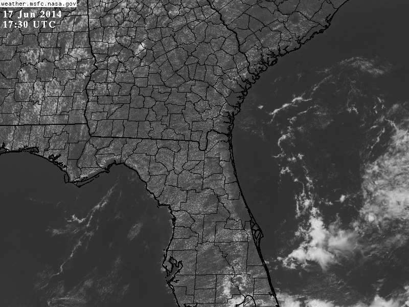
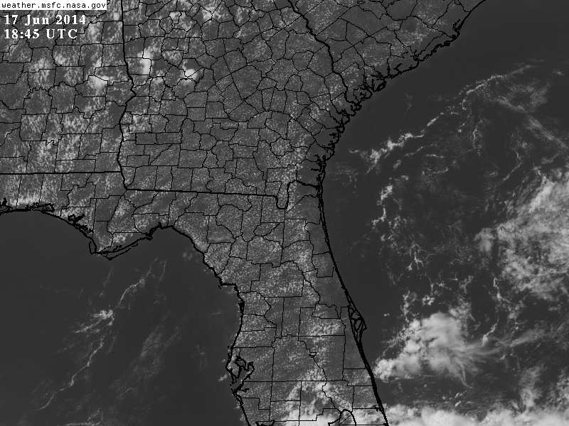
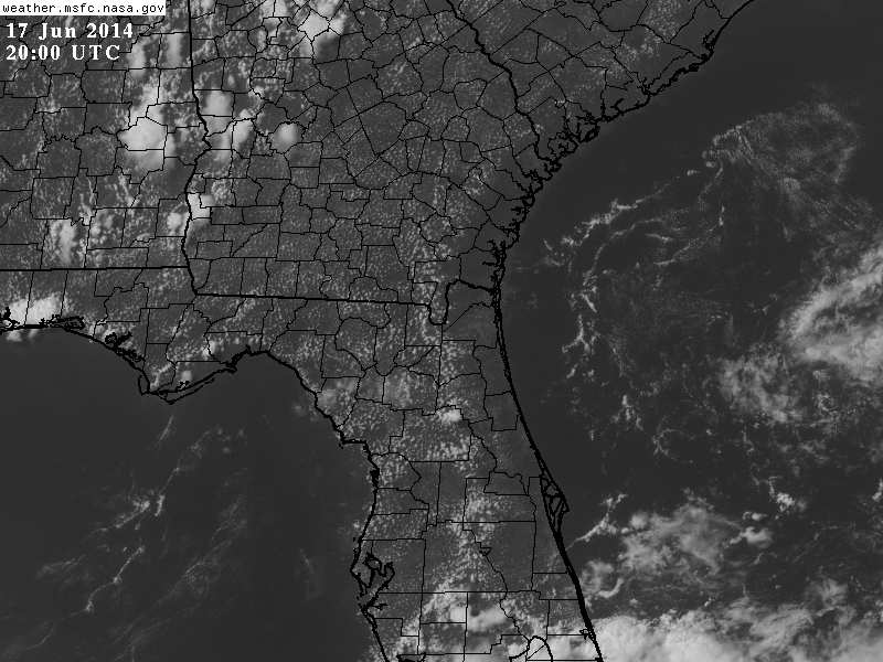
NASA Loop of Rapid Scan Imagery of Sea Breeze Fronts and Outflow Boundaries Over Florida
To understand the behavior of sea breeze fronts in the satellite imagery, one should keep in mind that they are small scale (mesoscale) or local thermal circulations that superimpose on and may be assisted or counteracted by the synoptic scale (weather map scale) wind circulations determined by the isobars on a surface analysis. Also, they take hours to "spin up" in response to surface heating from the sun, so they usually are not evident on satellite imagery until hours after sunrise.
Animation of synoptic scale easterly winds giving an "assist" to the FL east coast sea breeze while counteracting/suppressing the west coast sea breeze.
Sea breezes around peninsulas can enhance convergence that triggers convective development earlier than in other locations as in these GOES-16 ABI 0.65 micrometer visible images.
Animation